


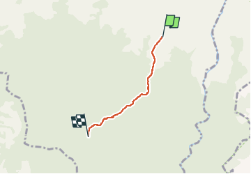

11.2 km | 18.2 km-effort


User GUIDE


FREE GPS app for hiking
 SityTrail
IGN / Geographical institutes
SityTrail World
The world is yours!
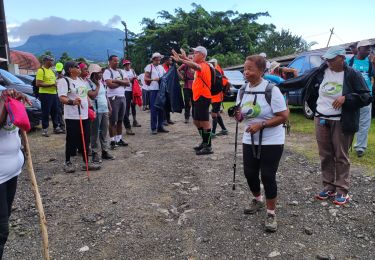
Trail Walking of 4.3 km to be discovered at Martinique, Unknown, Le Lorrain. This trail is proposed by Lamartiniere.
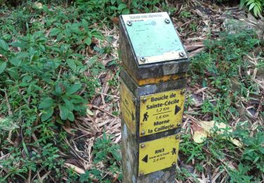
Carabin morne Jacob au panneau ONF accès interdit, sentier impraticable.


Walking
Walking
Walking

Walking

Walking
Walking

Walking

Walking
Walking